Spatio-Temporal
Analytics
A premium, high-fidelity command center built for unparalleled situational awareness. Meridian folds real-time event feeds, satellite telemetry, cyber correlation, and maritime tracking into a single deep-space interface — an OSINT command center you can read at a glance.
Visual Showcase
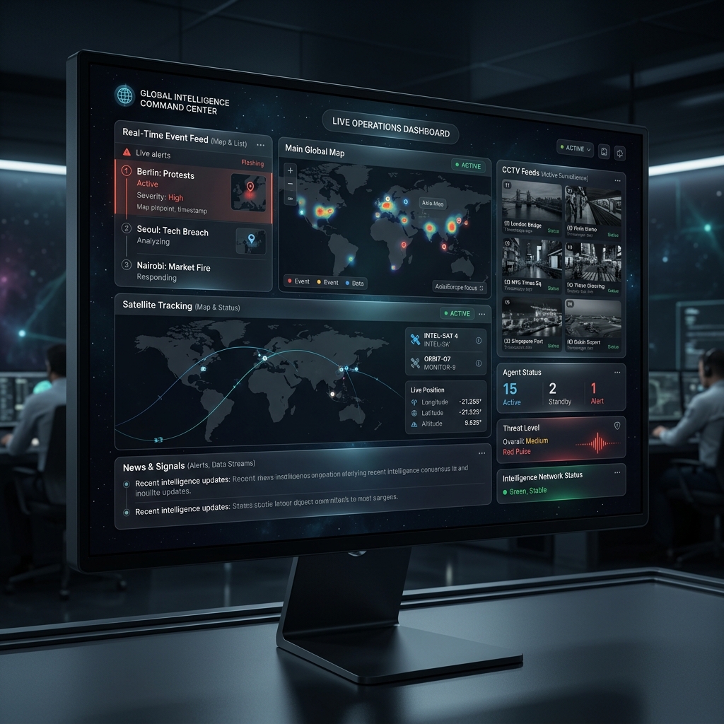
Note: some of these visual representations are concept-generated and may differ slightly from an active production environment.
Every signal, one field of view.
The core of the Meridian experience. Disparate data streams resolve into a single, cohesive view — built for maximum clarity without sacrificing the glassmorphic language that defines the platform.
- Real-Time Event Feeds: Global events unfold as they happen through dynamic, live-updating alert lists.
- Multimodal Visuals: Live camera feeds and satellite telemetry paths integrated into one canvas.
- Threat-Level Monitoring: At-a-glance indicators for operational status and global threat levels.
Visualize the invisible.
The Cyber Intelligence portal maps complex network activity, threat-actor behavior, and system vulnerabilities through intuitive node-based correlation graphs.
- Correlation Graphs: Rendered maps of the relationships between malicious IPs, botnets, and target networks.
- Geolocation Heatmaps: Pinpoint the exact origins of digital threats on a global scale.
- Threat Escalation Alerts: Color-coded prioritization of critical risks, surfacing the most important data first.
Track the world's oceans.
Designed for high-density tracking, the Maritime dashboard presents complex logistical data in a clean, easily digestible format across thousands of vessels.
- Live Vessel Tracking: Current positions, headings, and risk assessments for thousands of vessels on dynamic map interfaces.
- Operational Logs: Step-by-step history of vessel movements, weather warnings, and route deviations.
- Regional Activity Summaries: Quick breakdowns of high-risk regions — piracy hotspots and congested straits.
Ingest
Real-time event feeds, live camera streams, and satellite telemetry paths converge into the Command Center.
Correlate
Node-based graphs link malicious IPs, botnets, and target networks; geolocation heatmaps resolve threat origins.
Assess
Color-coded escalation ranks critical risks while vessel headings and regional summaries flag high-risk zones.
Act
Threat-level indicators and operational logs surface the decisive signal for the operator, first.
Design Philosophy
Meridian's aesthetic is not decoration — it is the interface. Every module speaks the same visual language, so an operator moving between the Command Center, the cyber graph, and the maritime map never loses the thread. Restraint keeps the signal loud and the noise quiet.
- Deep-Space Glassmorphism: Translucent panels over dark, atmospheric backgrounds — interfaces that feel alive.
- Premium Typography: Clean, modern, highly legible text that keeps dense data readable at a glance.
- Dynamic Micro-animations: Smooth transitions and hover states that make the command surface feel tactile and responsive.